Tag Archives: nature

Western survivors

On my first western trip, I visited Moab in July. We went hiking in 105 degree heat, the sun pounding the ground and anything above it. We learned to respect the desert, because the desert will win.

I always stop and admire the brave stalwarts of the desert—that scraggly tree growing from a forbidding rock face or that little flower, full of color if only briefly. They can never move. They survive or die.

In an ancient landscape shaped by wind and water on continents that no longer exist, the desert plants are ephemeral. Like the ruins of the southwest and our cities, the landscape will outlast them. But they, like us, can be beautiful for their time.

170413-canyon-de-chelly-2241_HDR

Scrub at Canyon de Chelly National Monument

170415-golden-throne-2976

Wildflower in Capitol Reef National Park

170417-bryce-4018

A lone tree at Bryce Canyon National Park

170418-kayenta-trail-4444

Wildflower at Zion National Park

Nature Nearby: Carlito Springs in Albuquerque

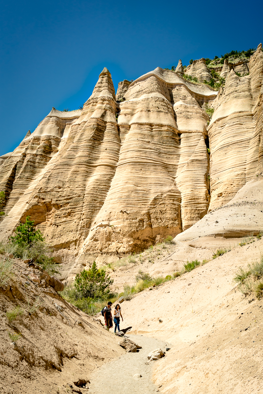
Amidst the many natural wonders of a state like New Mexico, it can be easy to overlook local gems like Carlito Springs. Located just 20 minutes east of downtown Albuquerque, Carlito Springs feels more like the Appalachian Mountains than the southwest. It’s a place with quirky New Mexico history, lush foliage, and inspiring landscaping.

160520-carlito-springs-7125


The History

Carlito Springs was first settled in 1882 by Civil War veteran Horace Whitcomb while he looked for gold. In 1930, it was bought by Carl Magee, editor of the Albuquerque Tribune and patent-holder for the parking meter. He named it “Carlito” for his son, Carl Jr., who died in a plane crash. (This link contains an excellent and more detailed history.)

Of course tuberculosis, America’s deadliest disease at the time, played a role in Carlito’s history. In 1910, 3000 of Albuquerque’s 13,000 residents were people seeking treatment in the dry, high air. Today, Lovelace and Presbyterian Hospitals, two of the largest systems in the city, remain from the tuberculosis treatment days. Magee’s wife was tubercular. The property was used as a sanitorium before Magee’s purchase.

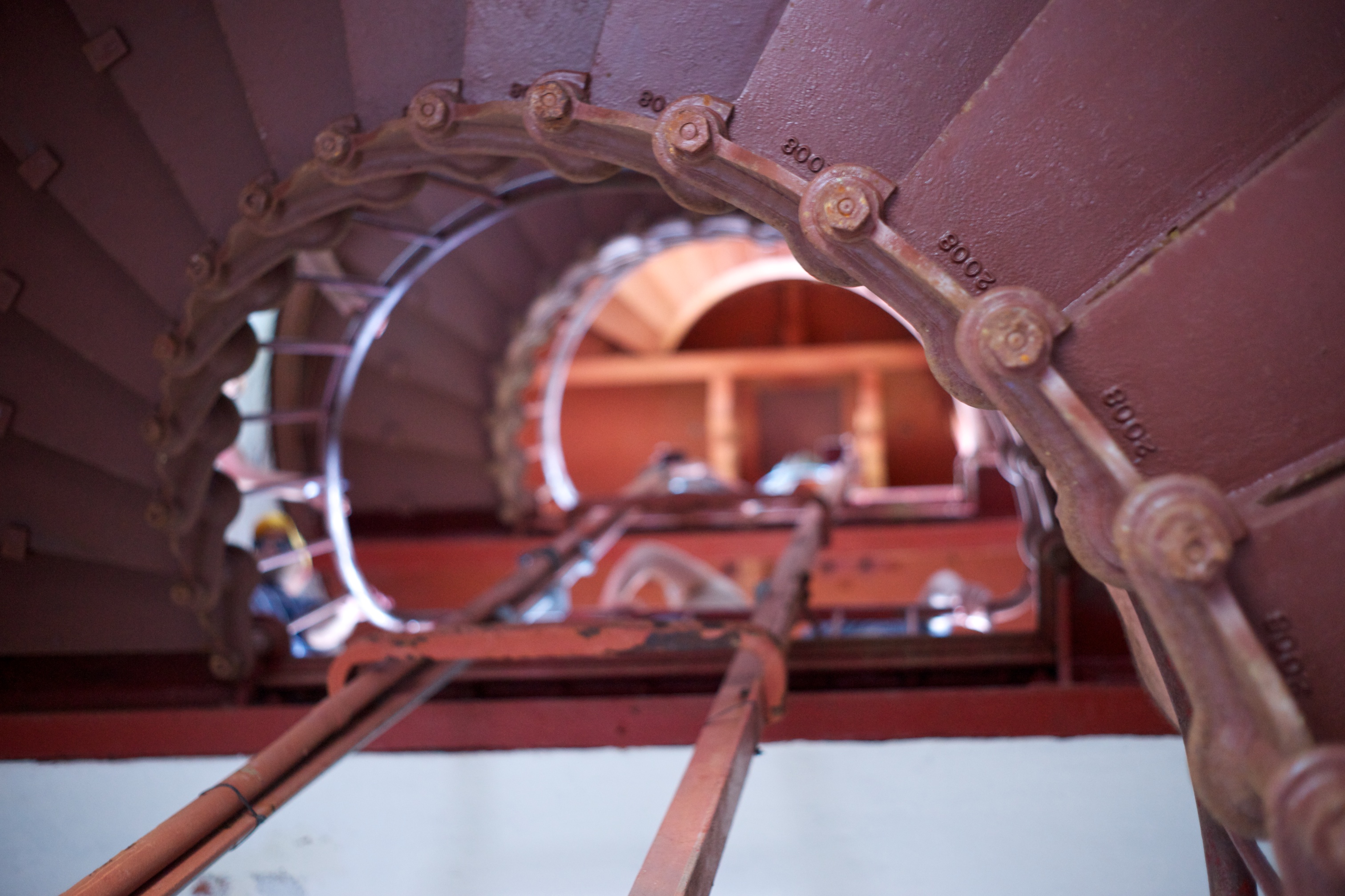
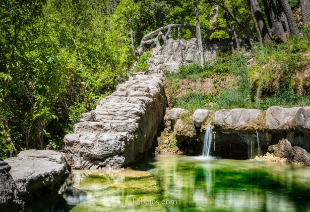
Magee’s daughter married a Sandia atomic scientist, and many of the features of the property date from that time. The pair won many ribbons at the New Mexico State Fair as “master gardeners,” and planted flowers and fruit trees on the property. Today, architect Baker Morrow calls Carlito springs “one of the most amazing landscapes in the southwest.” The property has several cabins, as well as the springs, several highly manicured fishing pools (no longer stocked), fruit trees and flowers. If you’re an engineering nerd like me, you can check out the rusty vintage concrete pourer, which I suppose was used to craft the lovely railings around the ponds.

Carlito Springs was only permanently opened to the public in August of 2014. Because the property is on the steep banks of Tijeras canyon, substantial work went into building the trails that lead to this historic property. They did a great job, and Carlito Springs is a great Albuquerque attraction.

This slideshow requires JavaScript.


The Hike

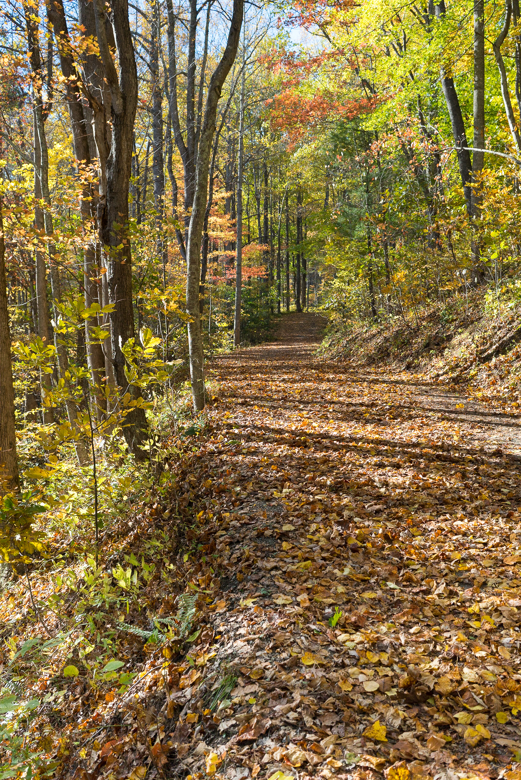
The hiking loop is about 2.4 miles, with about 400 feet of elevation change. From the parking lot, take the fork left for the most direct route to the cabins and ponds. This is the steepest section of the loop; it follows the springs up the side of the canyon, but it is cool and shady. The trails is good quality, without many rocks or roots to impede footing. The last few hundred feet before the cabins are switchbacks.

On the first leg of the hike, mind the poison ivy which grows near the trail. In May, there was quite a bit of it, neon green and inviting, but the trail is wide enough that it’s easy to avoid. By the cabins and on the second part of the loop, I didn’t see any.

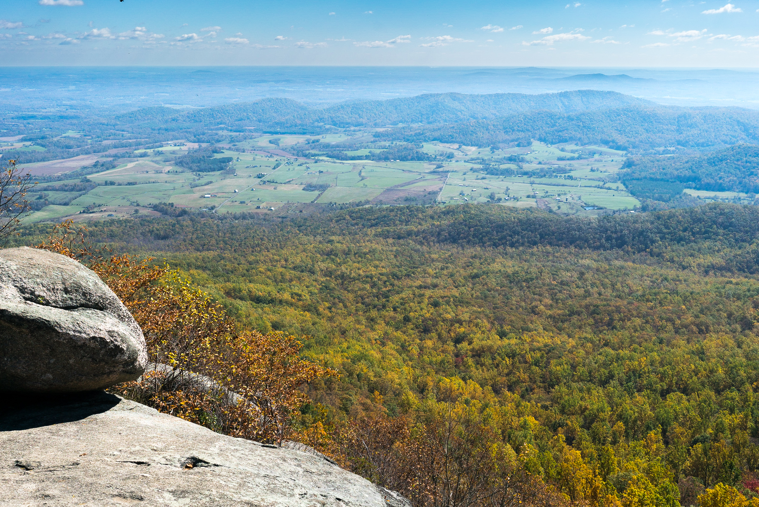
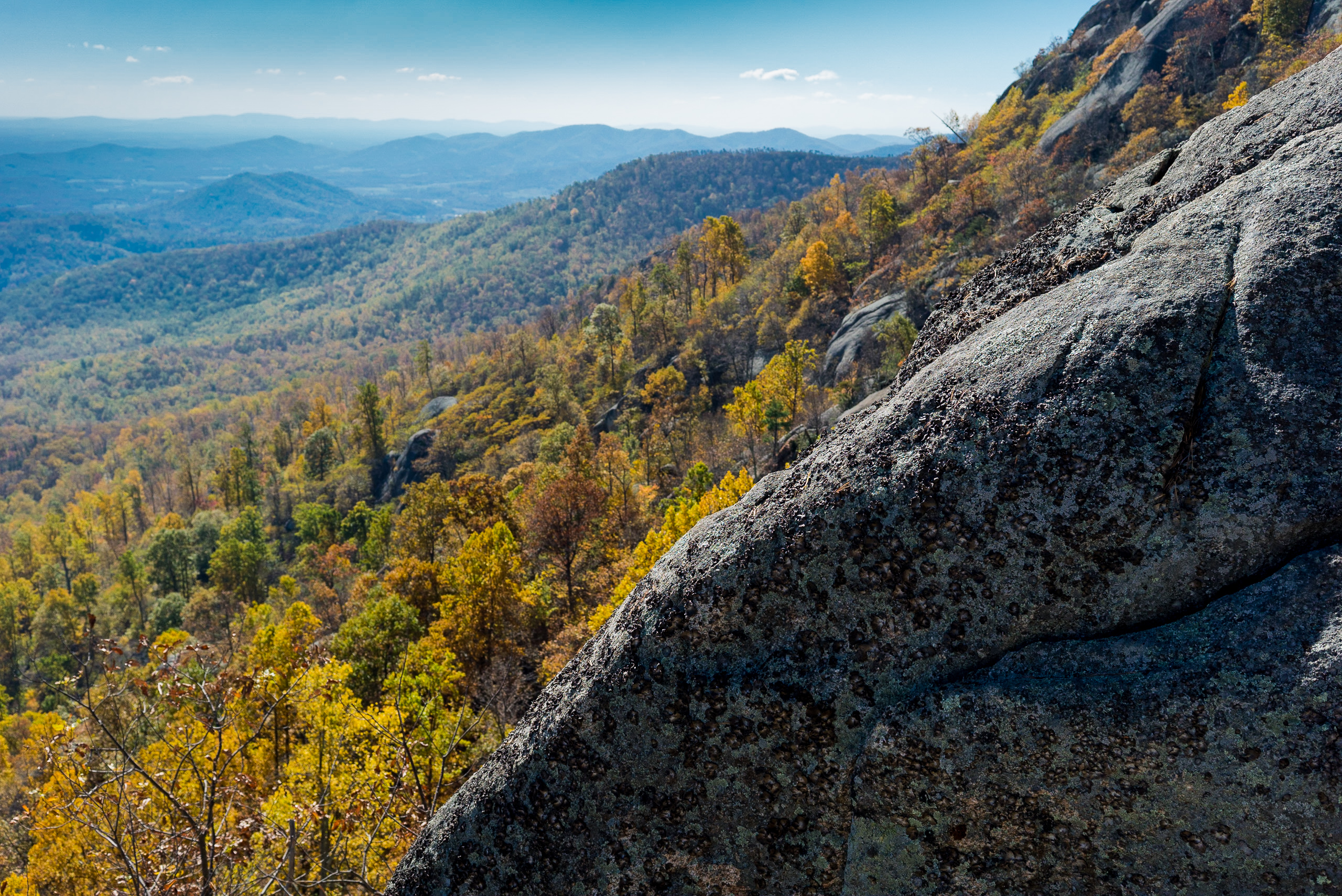
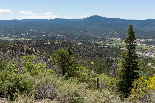
To the left of the cabins (if you are facing them), you can follow a small spur which leads to a view of the valley. It’s a steep walk and you get the view later anyways; when I do the hike again I will skip this spur.

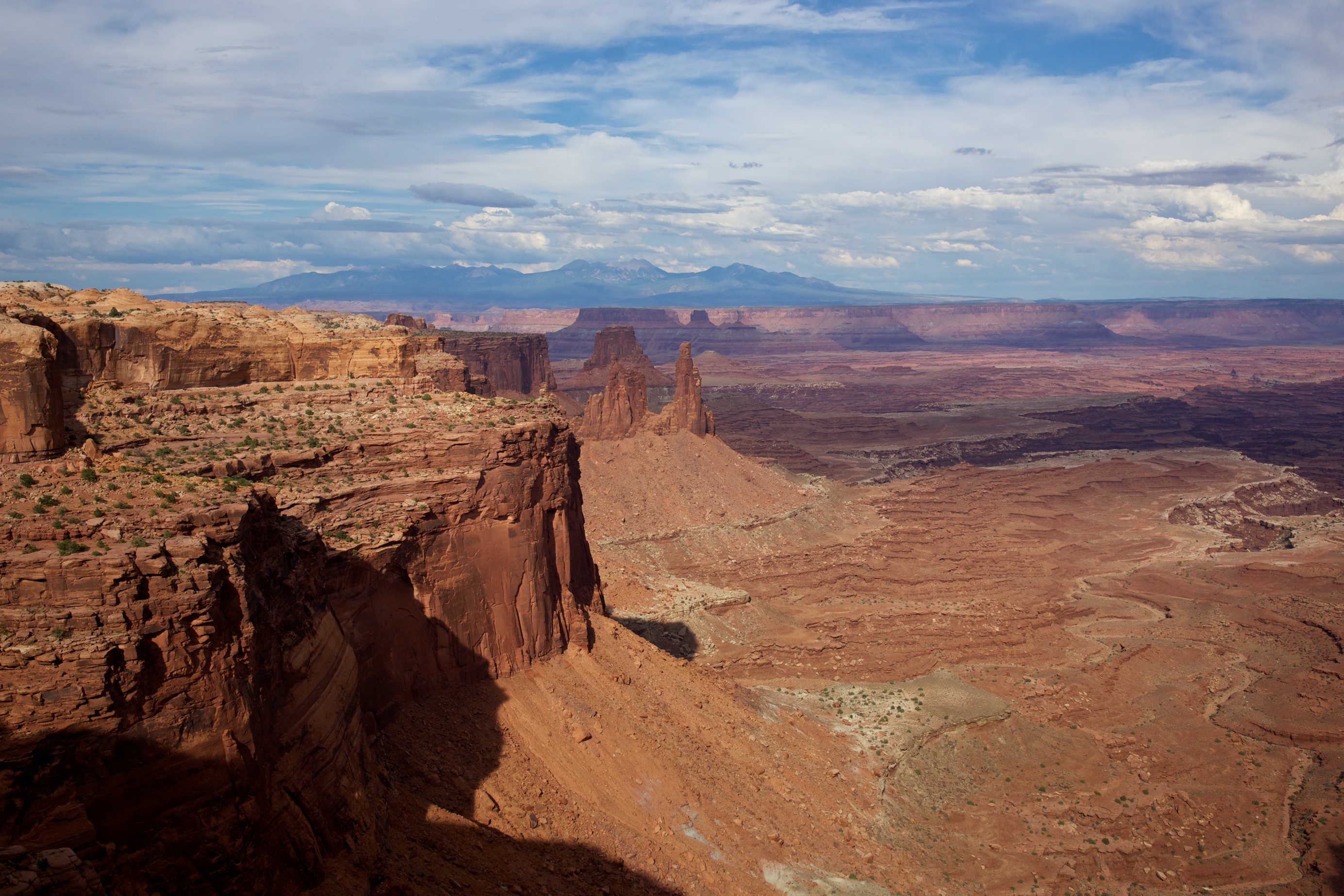
To the right of the cabins (again, as you face them) the loop continues. Just past the largest building, you will find the cement mixer, some various old rusted implements, and a port-o-potty. By the cement mixer, you can look into Tijeras Canyon, this time without the extra vertical effort. It’s a pretty enough view, besides the mining facility (which I omitted from my image).

160520-carlito-springs-6921

The final leg of the loop is sunny and gently sloping. Here, you see red soil and cacti rather than water and poison ivy. In May, the sun was pleasant, but this south-facing trail could be hot later in summer. We had this portion of the trail to ourselves.

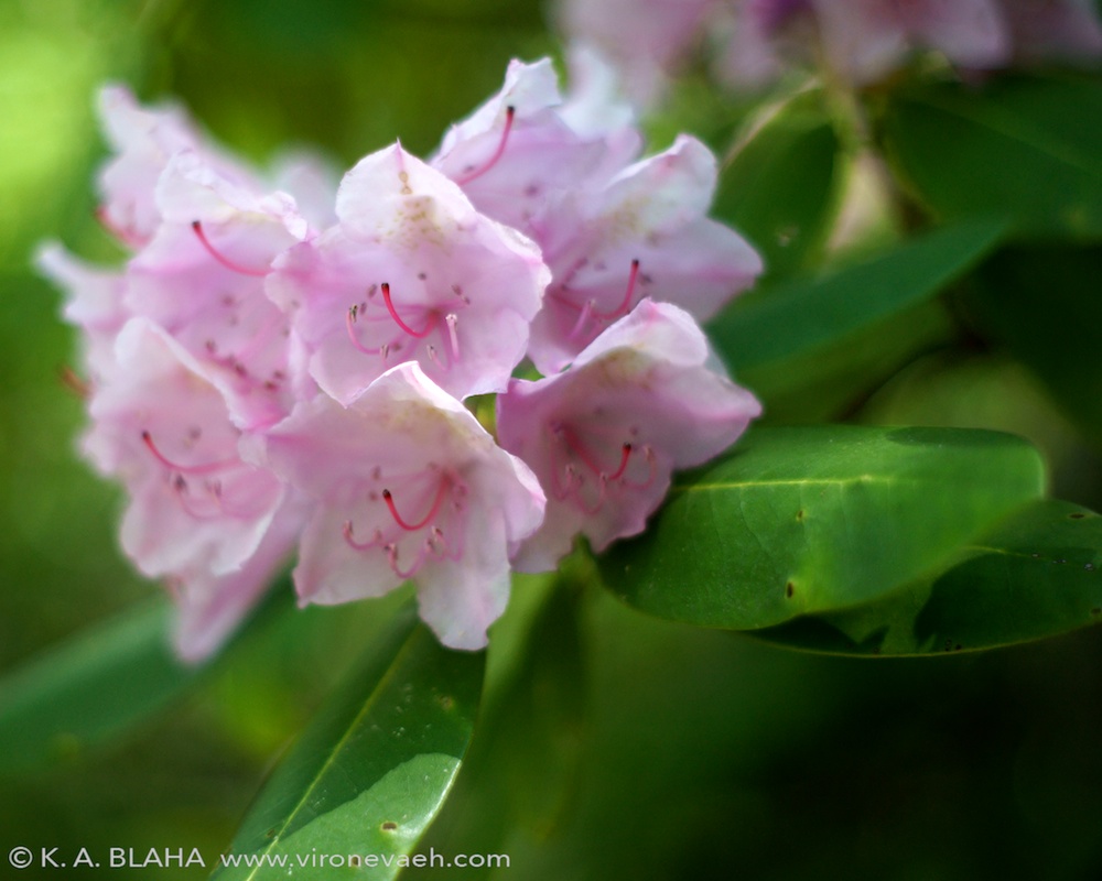
May was a great time for this hike. Up by the cabins, peonies and columbines bloomed. Later in the hike, cacti bloomed. We read about wildlife sightings such as bears and deer at Carlito, but on a busy Saturday, we had no encounters.


Extras

Carlito Springs is only a couple of miles from the famous “singing road” portion of Route 66. You can take Route 66 (Central Ave) from Albuquerque, or you can overshoot the Carlito Springs turn and u-turn. The singing portion is only eastbound. It’s silly, but entertaining.

Kasha-Katuwe Tent Rocks National Monument

Kasha-Katuwe Tent Rocks National Monument is between  Santa Fe and Albuquerque. It’s only about a 3 mile hike, with only 600 feet in elevation rise. If you want to visit Tent Rocks, arrive early, before the heat and the tour groups, and bring lots of water.

At Kasha-Katuwe Tent Rocks National Monument, you hike through a limestone slot canyon. Up above, there are formations of the most unusual shapes– some are like tents, some are like upraised fists, and some are like petrified dunes. It[s a testament to the power of wind and water in the west. My sorest muscle after this hike was my neck– from craning at all the great scenery.

150725-kasha-katuwe-tentrocks-0001-2150725-kasha-katuwe-tentrocks-0003150725-kasha-katuwe-tentrocks-0004150725-kasha-katuwe-tentrocks-0006150725-kasha-katuwe-tentrocks-0005150725-kasha-katuwe-tentrocks-0002150725-kasha-katuwe-tentrocks-0001150725-kasha-katuwe-tentrocks-0007

Merging photographs

Lately I’ve been improving my Photoshop skills with courses from Lynda.com. If you want to learn a design program, I strongly recommend them. In a year, I’ve learned so much about Photoshop, Illustrator, InDesign, Lightroom, JavaScript, CSS, photography, and more. In Photoshop alone, I learned way more than I figured out in 15 years of experimentation.

With my new learning, I’ve been able to breathe new life into old photos. Over the past several years, I took numerous sets of photos that I intended to turn into panoramas and HDRs, but then I could never get them to look right. With newfound skills come newfound confidence. Check out these beautiful images!


moab-composite-302

American Southwest near Moab, Utah at sunset. Assembled from 40 24-megapixel images captured with a Sony Alpha 100. When it was assembling, it tied up over 100 gigs of space. This version is 1500×557 pixels; the full size is 19,000 x 7,000!

moab-composite-302-zoom-detail

Detail from above photo, center-left at horizon.

SONY DSC

Mount Saint Helen’s in Washington state. Assembled from 6 24-megapixel images from a Sony Alpha 100.

SONY DSC

Detail from above photo, center left.

SONY DSC

Waterfall in Central Virginia along the Blue Ridge Parkway. High dynamic range image assembled from five slow-exposures. Smart sharpen and high pass filters to add sharpness and clarity.

SONY DSC

Rainforest in Olympic National Park. Before assembly, I reduced noise and applied lens corrections. High dynamic range image assembled from five exposures. Smart sharpen and high pass filters to add sharpness and clarity.


Hiking in the Appalachians


One of the most popular hikes in Virginia is Old Rag. It’s a 9 mile loop that climbs up and down Old Rag Mountain, including rock scrambles and plenty of elevation. In autumn, it is especially beautiful, however the trails were covered with damp leaves and occasionally very slick. My legs were putty the next day, but as you can see, the views were worth it.old-rag-00947 old-rag-00960 old-rag-00973 old-rag-00985 old-rag-01079

The Blue Ridge Parkway


The Blue Ridge Parkway is 469 miles long, connecting Shenandoah National Park and Great Smoky Mountains National Park. It is managed by the National Park System, though it is not a national park itself. Still, it has been the most visited part of the National Park System every year for over 50 years.

This weekend, I drove and hiked along a portion of it between Vesuvius and Roanoke, Virginia. It rained last week, so the vegetation was especially lush and the waterfalls especially spectacular.SONY DSCCrabtree Falls bottom-most waterfall, off mile marker 30 of the Blue Ridge Parkway. Highway 56, which leads to Crabtree Falls, is a beautiful drive whether you go east of the Parkway or west. We stayed in a cabin near these falls, and at night, we could hear the water rush.

SONY DSCThe James River.

SONY DSCOverlooking Buena Vista, Virginia shortly before sunset.

SONY DSCFurther into sunset near Buena Vista, Virginia.

SONY DSCVegetation approaching the Apple Orchard waterfall trail.

SONY DSCBlooming azalea bushes lined the trail to Apple Orchard waterfall.

SONY DSCApple Orchard waterfall near mile marker 78 on the Blue Ridge Parkway.

SONY DSCAnother waterfall on the Crabtree Falls trail. In 1.5 miles, you can see 4 different falls, though on the weekends it can be somewhat crowded. We went on Monday and shared the path with a different and slightly-too-exciting crowd: a rattlesnake and a six-foot long black snake. Nature!

May Flowers and the Richmond Botanical Garden


SONY DSC


One of the great pleasures of spring is enjoying all the plants that welcome spring too. I recently had the pleasure of traveling to the Lewis Ginter Botanical Garden in Richmond, Virginia, to enjoy the simultaneous blooming of azaleas, irises, and peonies. The Lewis Ginter Botanical Garden was recently voted the second best botanical garden in the country; it’s definitely worth a visit.

SONY DSC SONY DSC SONY DSC SONY DSC SONY DSC SONY DSC

Photography in the American West

This week I visited Moab, Utah. I stand-up (and fall-down) paddled on the Colorado River during a thunderstorm, I hiked in Arches and Canyonlands National Parks, and I stargazed. Most of all, I ravenously took pictures.

SONY DSC

Delicate Arch from across a gorge in Arches National Park

SONY DSC

Landscape Arch in Arches National Park

Mesa Arch in Canyonlands National ParkMesa Arch in Canyonlands National Park

Green River overlook in Canyonlands National Park

Green River overlook in Canyonlands National Park

Milky Way over the red rocks in the Colorado River valley

Milky Way over the red rocks in the Colorado River valley

The Colorado River valley

The Colorado River valley

Park Avenue in Arches National Park

The Gossips in Arches National Park

The Gossips in Arches National Park
Arches National Park

Arches National Park