Tag Archives: new mexico

Albuquerque International Balloon Fiesta

Part of life in Albuquerque is the annual balloon fiesta. For up to 9 days (weather allowing), 550 balloons launch at dawn and fill the skies; their adoring viewers fill the town. The fiesta adds a surreal whimsy to the week. More than once, I’ve walked outside to find a balloon 20 feet overhead, people waving as I stand sleepy with my morning tea. Sometimes the balloons have to land creatively, trying to avoid highways and power lines. Last year, I scheduled a doctor’s appointment on a morning during fiesta week. It was beautiful to drive into a field of glowing orbs but it didn’t bestow the greatest confidence in my fellow drivers.

When the conditions are just right, the wind forms a pattern called the “Albuquerque Box”. When The Box is in effect, ground level winds sink down the Rio Grande Valley, flowing south and higher winds flow north. By adjusting altitude (basically the only control for a balloonist), the balloon can circle back to the launching position. The Box was running both days I went this year, and we watched the pilots compete in navigation competitions.

This slideshow requires JavaScript.

Ten Favorite Images of 2016

Better late than never! I took a little hiatus from photography for the last few months. Now that I’m back in the saddle, it’s time to pick out my favorite ten images in the past year. (Here’s my 2015 list, which focuses a little more on technique.) This year I continued my western travels, learned about lighting (not shown here), and got really into HDRs (shown excessively here).

160105-boca-grande-beach-1988-edit-160105-edit-160105

Great Blue Heron in Florida

160213-bisti-wilderness-3965 3

Bisti Badlands in Northwest New Mexico

160213-bisti-wilderness-4540 3

Ah-Shi-Sle-Pah Wash in Northwest New Mexico

160223-still-life-5007 2

Sierpinski tetrahedron

160325-enchanted-circle-eagles-nest-9001_HDR

Eagle’s Nest Lake near Taos, New Mexico

160531-pikes-peak-9256_HDR_1

Looking towards Pike’s Peak in Colorado

160530-st-elmo-and-nearby-7856_HDR 2

St. Elmo, Colorado

160228-white-sands-5686 3

White Sands, New Mexico

160707-sunset-2303_HDR-2 2

Three Sisters Volcanos in Albuquerque, New Mexico

160923-taos-0103

Night sky in Taos, New Mexico

New Mexico History: The Battle of Columbus

Last week was the 100th anniversary of the interception of the Zimmermann Telegram (1/19/1917), in which Germany encouraged Mexico to attack the United States to keep them from participating in WW1. Ironically, the interception contributed to the United States entering the war in April. When we learned about the telegram in school as a child, the idea of Mexico attacking the US sounded laughable. In fact, Pancho Villa had attacked the town of Columbus, New Mexico nine months before. At the time of the Zimmermann Telegram, General John Pershing was hunting Villa in northern Mexico in the “Punitive Expedition.”

At the time of the Battle of Columbus, Mexico was several years into the Mexican Revolution. After 35 years, the presidency of Porfirio Díaz collapsed in 1911. A string of leaders followed; Francisco Madero ruled from 1911 until his assassination in 1913. Victoriano Huerto and Venustiano Carranza controlled different parts of Mexico in 1913-1914. In 1914, the United States assaulted the port of Veracruz, with Wilson stating his desire to overthrow Huerta. The United States then supported the presidency of Pancho Villa’s rival, Carranza.

The reasons for the Battle of Columbus aren’t fully clear, but they were probably partially motivated by Villa’s need for munitions and by his irritation that the United States was supporting his rival. Early on March 9, 1916, Villa attacked Columbus with 500 men. The raid didn’t go well for Villa. 90-170 of his men are estimated to have died. President Wilson sent General Pershing into Mexico to hunt for Villa for nearly a year. He evaded capture and entered pop culture fame. At the close of the Mexican Revolution in 1920, he agreed to retire to the country. He was assassinated in 1923 after re-involving himself in politics.

NM public lands: San Lorenzo Canyon

Of the 121,000 square miles that form New Mexico, roughly 21,000 of them are managed by the Bureau of Land Management. This land gets used a lot of different ways. Some of it is part of national monuments like Tent Rocks or Rio Grande del Norte. Land is leased for grazing, woodcutting, helium production, and oil and gas production. Land is used for hunting and fishing. Western ecologies are fragile and must be managed. Too much grazing and too much plowing lead to broad consequences, as demonstrated by the dust bowl. The BLM manages these uses, working to allow economic use of the lands without exhausting them. When we hiked in Bisti Badlands, we dodged dried cow patties from previous grazing; I was glad we could both use the land.

New Mexico BLM manages several dozen recreation sites, offering rock climbing, mountain biking, hiking, camping, and more. Saturday I visited San Lorenzo Canyon, which is near Socorro. We drove several miles up a wash into a canyon. We enjoyed hiking and a little rock climbing. December hiking in New Mexico can be pretty great. See for yourself!

The Art of the Park

I’ve posted many times before about my love for WPA-era travel posters and some of my own tribute work. I have a wall of stylized postcards that I have collected along my travels. Like the parks passport stamps I described a few months ago, the WPA postcards became an exciting item to collect. Every time I have a visitor in my home, we talk about the parks. Bureau of Land Management, National Park Service, county open spaces, state parks, they are all wonders of the west and worthy of a place on the wall. Not all of these places have postcards, which I am slowly working to remedy. But today’s post is about the great parks’ art that I have accrued and slathered upon my walls.

Below I include a few of my favorites from the wall. Some of the cards I like the depiction of the specific piece of scenery, others I like the color palette or the stylization. We all have stories about our visits to parks. These cards tell stories; the stories of these cards have augmented my stories. They let me dream for weeks and months after a trip about the animals, the scenery, the history, and the cultures of the parks I visited.

New Mexico has 14 National Monuments, extensive Bureau of Land Management sites,  wildlife reserves, open spaces, state parks, and more. In a future post, I’ll talk about my work to create posters for the New Mexican sites that lack them today.

This slideshow requires JavaScript.

Western Skies: Sunsets

After a year in New Mexico, some things grow familiar. Red or green chile goes with everything, in the morning there’s probably a hot air balloon somewhere, and at night I will hear people gunning their engines on Route 66. But the New Mexican sky still amazes me. Whether its the stars at night, the distant rain, or the views of mountains for miles, it’s so different than the skies I have lived under for the rest of my life. In Missouri and Virginia, the sky was overhead. In New Mexico, it wrap around you like a bowl, a massive semi-spherical window into the universe.

This slideshow requires JavaScript.

Mimbres Pottery

Although we think of the west as new, it’s only new to the United States. Many native cultures and the Spanish Empire traipsed across the Southwest for centuries and millennia before it was the American frontier, and their legacy remains. As an easterner, nowhere I’ve ever lived had that depth of surviving history. I still have a lot to learn.


The Mogollon (roughly pronounced MUH-guh-yun) Culture was one of three ancient cultures in the southwest, along with the Pueblo and the Hohokam. The Mimbres branch of the Mogollon lived in southwest New Mexico. The people of the Gila Cliff Dwellings only lived there for about a generation, likely driven there by desperation. Compared to Chaco Canyon and Mesa Verde, the Gila Cliff Dwellings are quite small. The culture disappeared from the region shortly thereafter. But their pottery remains influential today, over 500 years after the culture that produced it collapsed.

Mimbres pottery is astonishing. Many southwestern cultures have beautiful pottery with rich design and symbolism. Mimbres pottery is different. It depicts compelling geometric abstractions of animals and people, employing artistic devices not seen in European art until this century.

The Maxwell Museum of Anthropology in Albuquerque has a nice collection; I picked up a great book of designs in the gift shop, Mimbres Classic Mysteries by Tom Steinbach Jr. Most books about Mimbres pottery show photographs of the works. This book shows the designs themselves, which are brilliant. All images in this post are from that book.

fullsizerender-13

Sandhill crane design, almost like something from the art deco movement.

fullsizerender-14

Humorous design featuring a great blue heron, with the fishes hiding in the one place the heron’s neck cannot reach.

fullsizerender-15

Intertwined ram’s heads

fullsizerender-16

Man/crane design. The author suggests it looks like a Picasso. I am struck by the use of negative space.

fullsizerender-17

Bat design

Exploring New Mexican Names: Mount Taylor

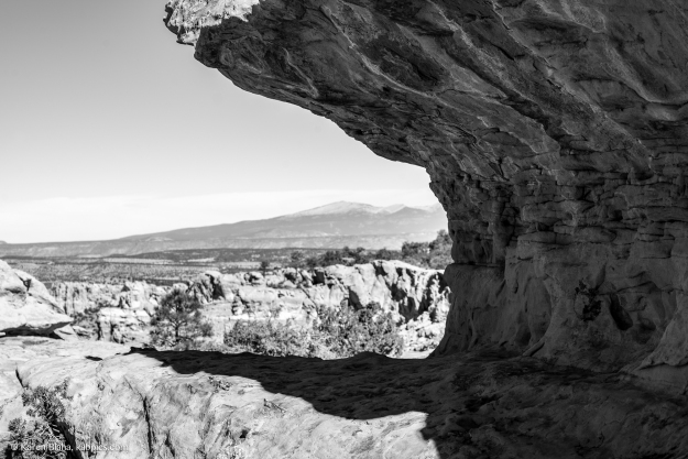
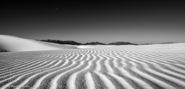
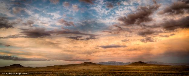
Mount Taylor is a volcano 80 miles west of Albuquerque, the most prominent feature in the western panorama looking from the foothills of the Sandias. It was named in 1849 for then-President Zachary Taylor. The Navajo call it “TsoodziÅ‚” (don’t ask me to pronounce that), and the mountain is important in the beliefs of the Navajo and local pueblo peoples. The mountain is rich in uranium, and was a mine until 1990. In nearby Grants, you can visit a mock uranium mine. Mount Taylor is also the site of the grueling-sounding Mount Taylor Quadrathlon, featuring biking, running, cross-country skiing, and snowshoeing. 

Zachary Taylor was the second and last Whig to be elected to the presidency. Both he and William Henry Harrison were generals, and both died early in their presidential terms. Taylor was mostly apolitical; the presidency was his first elected office. He fought in the War of 1812, against the Black Hawk Indians in what is now Minnesota, and against the Seminoles in Florida. He became known as “old rough and ready.” His daughter married future president of the Confederacy Jefferson Davis, but she died three months into the marriage.

Taylor came to national prominence during the Mexican-American War. This war eventually brought the territory of New Mexico into the union, and is detailed in Amy Greenberg’s A Wicked War. Taylor won famous victories in the Battle of Monterrey and the Battle of Buena Vista. The war was initially popular, and Taylor became correspondingly popular after his victories. Taylor privately opposed the war from its beginning, calling an early troop movement “injudicious in policy and wicked in fact.”

Democratic president James K. Polk (1845-1849), who had almost single-handedly created the war, grew frustrated that Taylor, a whig, was getting credit for what Polk considered democratic achievements. Before the Battle of Buena Vista, Polk stripped Taylor of a portion of his troops, leaving Taylor and his troops more vulnerable to attack from the army of Mexican general Santa Anna. Santa Anna was a busy boy in early Mexican history; he was president 11 nonconsecutive times, and he was the leader of the Mexican forces at the Battle of the Alamo in the Texas revolution. As time passed, the war grew unpopular, and so did Polk. After the invasion of Mexico City, the war stagnated, with US forces harassed by guerrilla warfare. US troops committed atrocities, such as the Agua Nueva Massacre. Polk wanted to annex all of Mexico, and some wealthy individuals in Mexico preferred this to the constant coups that plagued early Mexico. But would this territory permit slavery? And how would dreaded dark skinned Catholics be allowed to become citizens? Eventually, the upper one-third of Mexico’s territory was ceded to the United States in the Treaty of Guadalupe Hidalgo (a treaty that Polk opposed, but grudgingly accepted).

Taylor never saw Mount Taylor nor set foot in New Mexico, as far as I can tell. But he made his mark on the modern state of New Mexico in a couple of ways. The Mexican-American War brought most of the territory of New Mexico into the United States. And during his brief presidency, Taylor opposed Texas’ claims to the eastern half of New Mexico. Thanks in part to President Taylor, I live in New Mexico and not Texas.

Taylor assumed the presidency in March of 1849. Perhaps Polk resented this, but not for long; he had the shortest retirement of any president, dying just three months after leaving office. In the 1800s, presidents took office on March 4th after the election. Because March 4th, 1849 fell on a Sunday, Taylor refused to be sworn in. This led to “President for a Day” David Rice Atchison, who is slightly famous in my home state of Missouri. Taylor lacked specific policies and history considers him to be in the worst 25% of presidents. On July 4th, 1850, President Taylor ate some fruit and milk at a Fourth of July celebration. He became ill and died on July 9th, leaving Vice President Millard Fillmore, who is rated even worse than Taylor, historically. Polk, incidentally, is rated 10th best president, a ranking I suspect the author of A Wicked War disagrees with.

Perhaps someday I will learn how to pronounce Tsoodził, what it means, and the names and meanings of Mount Taylor in the Puebloan languages. Until then, I suppose Old Rough and Ready will have to do. He seems like the sort of person one makes do with.

151114-el-malpais-04235-2


Western Ghost Towns: St. Elmo, Colorado and Chloride, New Mexico

The west contains amazing variety. You can see lava fields, slot canyons, and dunes of white sand. There’s 400 years of Spanish history, and thousands of years of native history from multiple cultures. Artifacts in the hills and deserts of the west will stay put for a long time. The Animas River Spill led to coverage of abandoned mines in the west, remnants of the 1880s mining boom. This article at least suggests 150,000 abandoned mines, 4,000 of them uranium mines. On a happier note, many of the old mining settlements survive in some form today.

St. Elmo, Colorado is a beautiful little mountain town with nature and scenery. Its wooden buildings have been preserved very well, and are well-suited to photography.

Chloride, New Mexico, had one of the most excellent and unique museums I have visited. Mr. Edmund at the Pioneer Store Museum has spent decades of his life cleaning and documenting the store and the town history. He gave us a wonderful personal tour for over an hour.

St. Elmo, Colorado

St. Elmo is in a remote valley of central Colorado near the Arkansas River headwaters. We stopped by en-route from Great Sand Dunes National Park to Pike’s Peak. St. Elmo is a quintessential mountain ghost town, with beautiful timber construction, moody skies, and looming snowy mountains. Its population peaked at around 2,000 people. St. Elmo had gold and silver mining (over 150 claims in St. Elmo alone). It was near the Historic Alpine Tunnel, an engineering marvel, built in the 1880s and still the highest rail tunnel in the country. (If you want to see that, that requires some walking.)

When the railroad stopped maintaining the rail line in 1910, the town faded. One family stuck around, and today a lot of buildings survive in lovely condition. St. Elmo has mountain biking, an adorable-looking Bed and Breakfast, ATV trails, and more. Also nearby is Mt. Princeton Hot Springs, which looked inviting.

This slideshow requires JavaScript.

Chloride, New Mexico

How can you not adore a name like Chloride for a mining town? Chloride was named for its silver chloride deposits, and was a silver town. At its peak, it reached a population of 3,000 with 9 saloons. (Today, it has 11 residents.) The town collapsed when President McKinley made gold the monetary standard, and silver prices plummeted. Chloride had 42 mines, a crushing plant, and a smelter.

The general store continued on after the mining bust. In 1923, it was boarded up while the son went east to study. He studied physics and moved to California, so the store sat unmolested (except by bats) for 70 years. It is a time capsule rich with history. You can peruse the signatures in the post office book. The museum manager, who restored the building and its contents himself, will show and tell you about the many fascinating items within the store. There are purchase records, old bottles of whiskey, packages of gum, nails, ladies hats, and even a dynamite detonator.

Today, one mine is still active nearby, mining zeolites, which are cool, but a tale for another time.

This slideshow requires JavaScript.


Chaco Canyon: New Mexico’s ancient convention center

Chaco Culture National Historic Park is in remote northwest New Mexico. The drive will take you on twenty miles of dirt roads and beyond cell range. But in this most remote reach of New Mexico lies the crossroads of an ancient culture. In Chaco Culture National Historic Park lies 3,614 recorded archaeological sites, including many massive great houses. The largest, Pueblo Bonito,  has roughly 800 rooms; visitors may walk through the doors and rooms of Pueblo Bonito. The Chaco Culture also built astronomical features into many of their works; some windows align perfectly with the sun on solstice, and some decorations align with phases of the moon.

When Chaco was discovered in modernity, it was thought to be a vast city. Having walked through it, it feels that way. It feels like it could hold thousands. But archaeological evidence suggests otherwise—there is little garbage, and few burials. Massive Pueblo Bonito may have housed only 70 people on a permanent basis. The guides at the park suggest that Chaco might have been a meeting ground, used for trade and weddings and astronomical ceremonies for a small portion of the year. Remnants of cacao from 1200 miles south have been found at Pueblo Bonito. The bones of macaws, native to eastern Mexico, have been found at Pueblo del Arroyo. They apparently didn’t flourish; only the bones of adults were found. So the astonishing quantity of ruins at Chaco Culture Park may be the remnants of an ancient convention center.

Chaco offers an amazing range of ruins, from the many-roomed grand houses to petroglyphs to astronomical markers to ancient stairs and roads. Like Mesa Verde National Park, not so far to the north, the whole site was abandoned in the 1300s, well before European influence. Like Mesa Verde, archaeologists don’t know exactly why the people left. There is evidence of an ancient drought. Some argue for catastrophic deforestation after all the building at Chaco (because all that construction took a terrific amount of timber, some of which still remains in the structures), though there is not consensus.

I grew up in St. Louis, a town once called Mound City for the mounds left by the ancient Mississippian culture. The massive city at Cahokia was also abandoned around the year 1300. A city of 15,000 abandoned, around the population of London at the time, and we don’t know why. It’s easy to live in the United States and think of it as the new world. But these amazing works of ancient people live on quietly. The inconvenient mounds of St. Louis were largely destroyed; those who did so may not have even realized their origin. But the remnants of the Pueblo culture at Chaco remain, mostly protected by their isolation over the years. Though the journey today is easier than it ever has been, Chaco is still hours from the interstate and quiet. As I took in the ruins, I was filled with the same wonder and questions that Cahokia Mounds always presented. Places like Chaco and Cahokia are reminders of humanity—no matter the size of the structures we build, one day people will view the barren remnants and wonder about us. We will walk the same valleys and cliffs, touch the same stones, but we won’t know each others names or voices or values. Ruins like Chaco remind of us of our place in the universe, and how beautiful and belittling that can be.


This slideshow requires JavaScript.

This slideshow requires JavaScript.

160611-chaco-canyon-0717

The stars through my tent at Chaco Culture Park. Chaco is one of the night sky parks, where the darkness of the sky is specifically preserved through lighting choices and such. In light of the ancient Pueblo interests in astronomy, it seems appropriate.

160612-chaco-canyon-0877_HDR_1

Sunrise at the camp site.