Like so many of us sci-fi-ers, I grew up on science fiction television. I remember watching Star Trek Next Generation in a high chair, and later I watched Babylon 5 and Voyager. I feared the space under the bed because my brother told me it contained a black hole. I drew aliens, made up planets, and wrote in codes. Once a friend cut the bridge of my nose with a hardcover book during horseplay, and I was delighted to declare myself Bajoran.
In 5th grade, we had the city project; we had to invent a city, describe its economy, design a model of it, and write a small essay. It was my catalyst. I created a city called Vironevaeh, set on a distant planet, colonized by humans from Earth in the distant future. My languages, my maps, my characters, my aliens now had a focal point.
That was 19 years ago. Once a year, I like to look back and celebrate all the fun I’ve had since. Dreaming about world building made me look at our own world in odd ways.
For now, Vironevaeh is just my little place. Maybe someday it will be something different, but more than anything, I love the journey.
Trips down memory lane
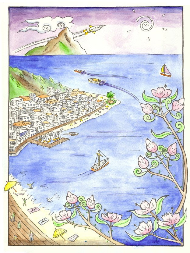
Below are a pair of landscapes, one from years ago and one from last year. My longing to depict Vironevaeh forced me to draw for a purpose. The pencil drawings was one of my first landscapes ever. The poster was an homage, and and another experiment in new territory: art nouveau and posters.
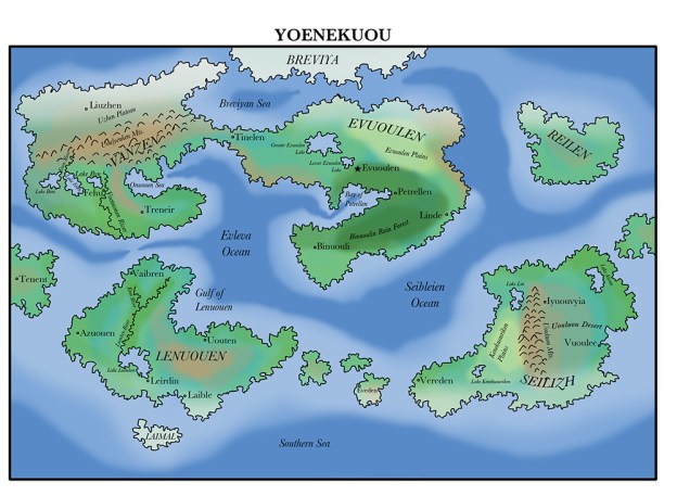
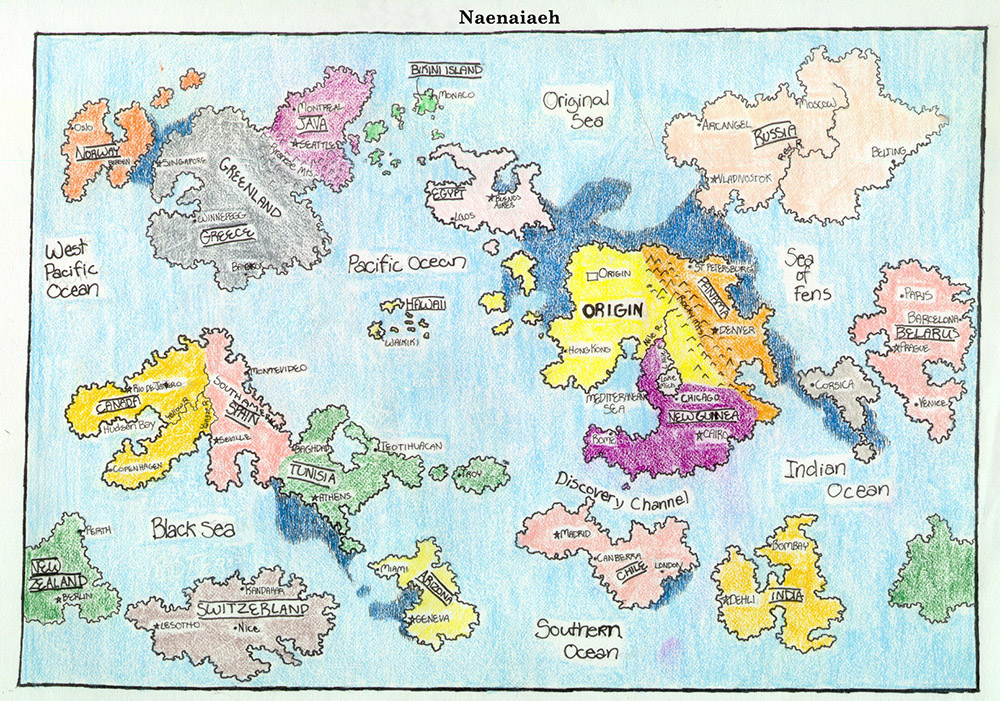
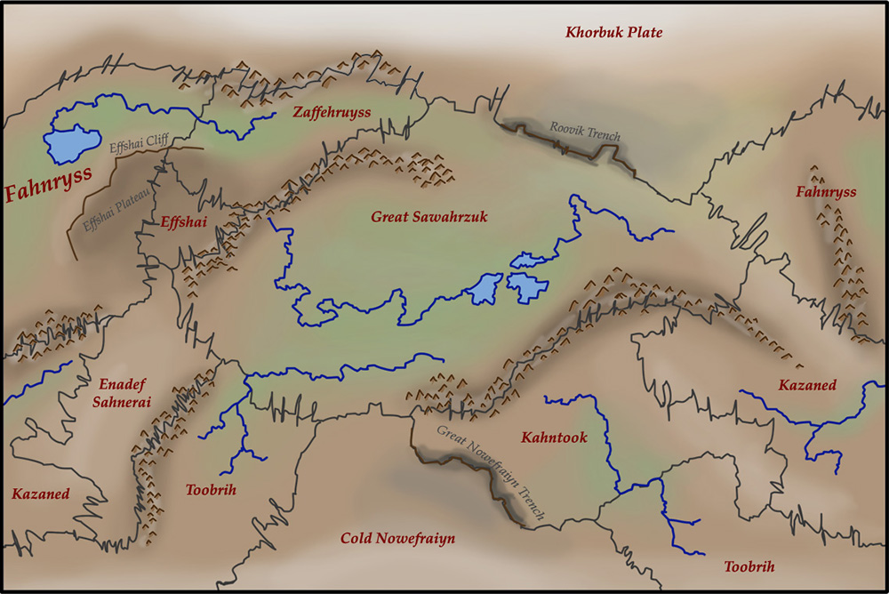
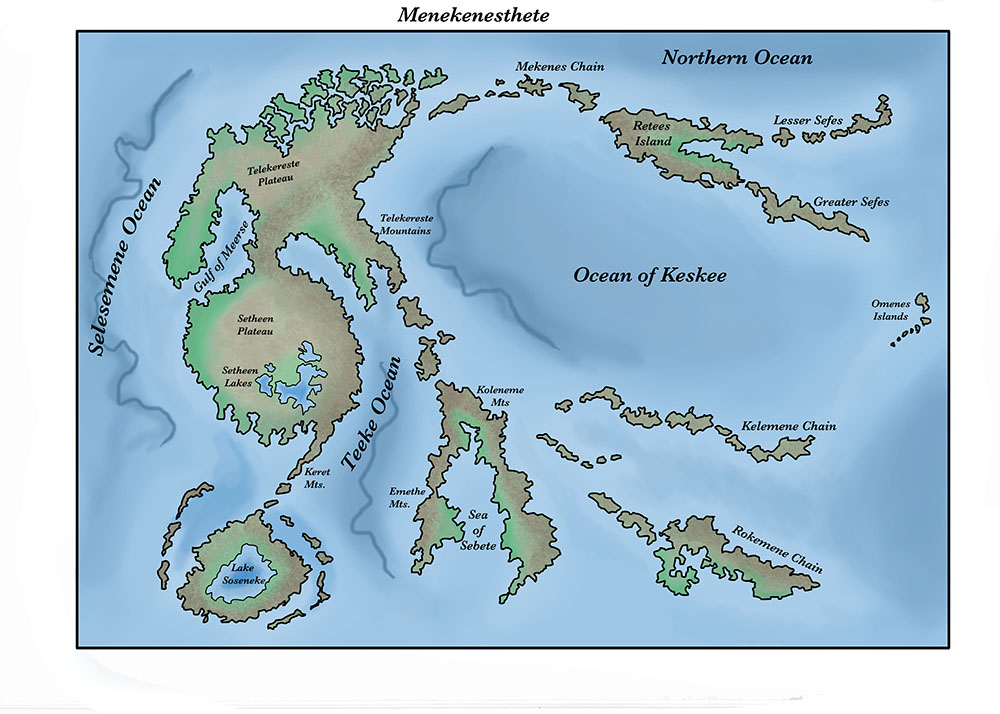
Maps
Maps are a simple staple of scifi and fantasy, but drawing maps made me ask a lot of questions. What kinds of geology could happen on a planet that could still sustain humanoid life? Or non-humanoid? Where should lakes, mountains, deserts, and oceans be in a realistic environment? What kinds of names would places have? What names would be linguistically compatible? What kind of linguistic range could I expect on a planet–how much would it vary in a place with a global culture versus one with regional cultures? What kind of stories would I tell about the people on such planets based on the map, and for the people whose stories I had already imagined, what kinds of maps would that require? Maps seem dry and factual on the surface, but I found myself asking a million such second-level questions. I love maps.
Storytelling
Vironevaeh filled me with stories, but I struggled to express them as I felt them. I have written my stories so many ways. Nowhere is that more rapidly evident than in my portraits. Below are four portraits of a character over six or so years. I had to learn to get the details right and be honest with myself where it wasn’t right. As ever, it’s a work in progress.


Places for the people
Maps and people weren’t the end, I wanted to know how the streets looked. That’s really hard! There’s architecture and materials, and then there’s imagining the landscape and how such things would fit in. I studied pictures of streets from around the world. I find this aspect the most challenging, but maybe also the most rewarding.
Stories of a new world
As I told stories about a new world, I wondered about their stories. And when I told them, I found that they fit everywhere. How many references to the garden of Gethsemane exist in western literature? A new place would have new Gethsemanes. Below are two images from mythology about a mouse, and new people finding that mouse in new constellations.


It’s never the end. Next year I’ll have new thoughts to share. Every year I am a new person, and Vironevaeh is a new place.